
14-Day Ring Road Iceland Itinerary
Iceland is such a beautiful country, from our first visit comes this ring road Iceland itinerary, that showcases that beauty in all its glory. This was our first trip to Iceland and we fell in love with the country! The Iceland road trip was also our first road trip, which made us fall in love with road trips, back in 2006.
The Iceland ring road length is 1332 kilometers/828 miles. Iceland’s famous ring road is a nickname. So what is the ring road in Iceland? Well you’ll actually be driving Route 1 or Þjóðvegur, which encircles the island.
A road trip around Iceland could technically be driven in 12 to 13 hours, but that would be a pity, since the stops are worth your time. Besides that you won’t be able to reach 100 kilometers/62 miles an hour on the whole route, due to the weather. So how long for the Iceland ring road? Well it starts at 4 days, but our Iceland road trip itinerary is 14 days. Giving you lots of time to explore the island to its fullest.
Ring Road Iceland Itinerary
Day 1: Drive from Keflavík to Auðholtsvegur (161 kilometers/100 miles, about 2.5 hours)
Day 2: Drive the Golden Circle
Day 3: Drive from Auðholtsvegur to Kirkjubæjarklaustur (206 kilometers/128 miles, a bit more than 2.5 hours)
Day 4: Snowmobile Tour
Day 5: Drive from Kirkjubæjarklaustur to Djúpivogur (301 kilometers/187 miles, about 4 hours)
Day 6: Drive from Djúpivogur to Hallormstadhur (210 kilometers/131 miles, about 3 hours)
Day 7: Hike to Litlanesfoss + Hengifoss
Day 8: Drive from Hallormsstadhur to Þingeyjarsveit (268 kilometers/167 miles, about 3.5 hours)
Day 9: Whale Watching Safari
Day 10: Drive from Þingeyjarsveit to Varmahlíd (172 kilometers/107 miles, about 2 hours and 15 minutes)
Day 11: Drive from Varmahlíd to Ólafsvík (320 kilometers/199 miles, about 4.5 hours)
Day 12: Boat Tour + Bjarnarhöfn + Kirkjufell
Day 13: Drive from Ólafsvík to Reykjavik (350 kilometers/217 miles, about 5 hours)
Day 14: Explore Reykjavik + Going home

Day to Day Itinerary
Lots of driving and highlights of Iceland each day on this Iceland ring road trip.
Day 1: The Blue Lagoon
On the first day you arrive at Keflavík Airport and drive to The Blue Lagoon in Grindavík. It’s expensive and a really touristic thing to do. Although there are more hot water springs in which you can swim in Iceland, to us The Blue Lagoon had something special. It was the most crowded place during our trip, already back in 2006. Make reservations beforehand.
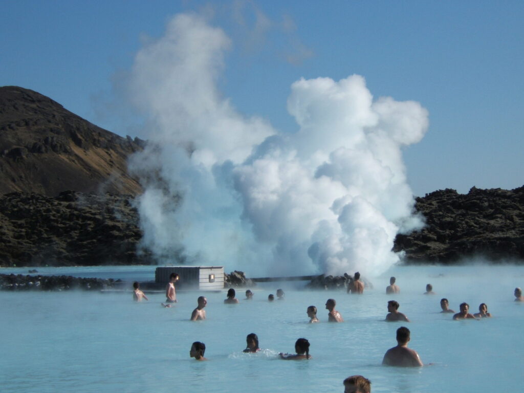
The water you get to soak and swim in is geothermal seawater. It’s a milkblue color. The water is warm and mineral rich. There’s a whole spa part, which we didn’t participate in back then, we just soaked in the water.

After your visit to The Blue Lagoon drive to Auðholtsvegur via Reykjavik.
Day 2: Golden Circle
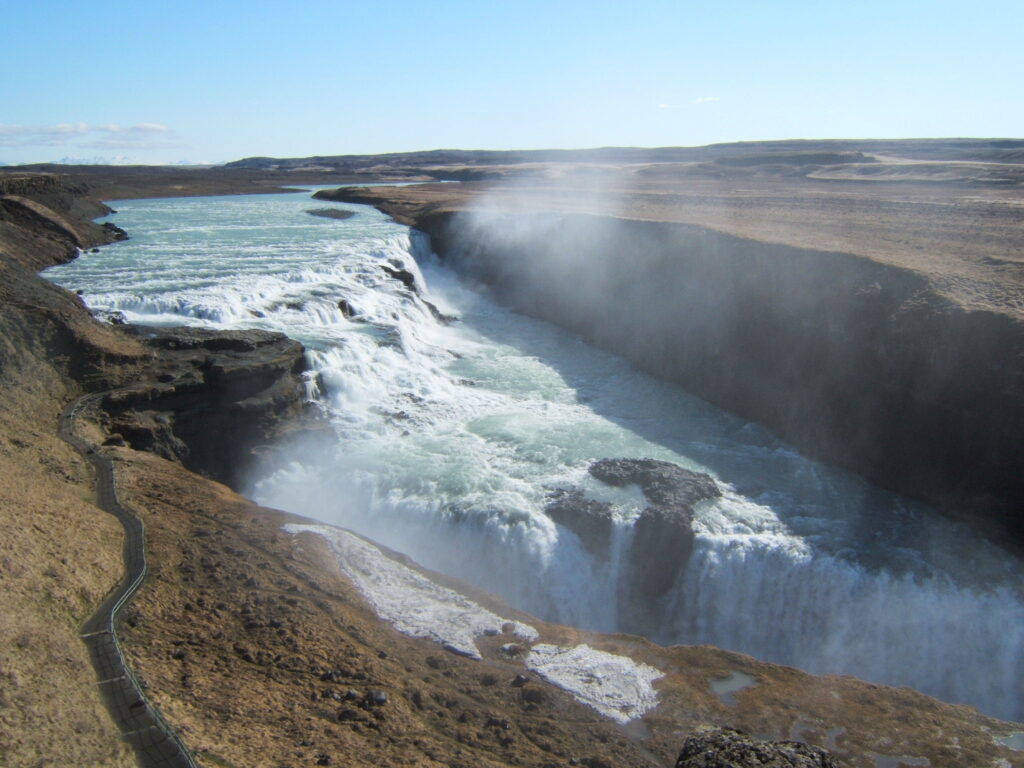
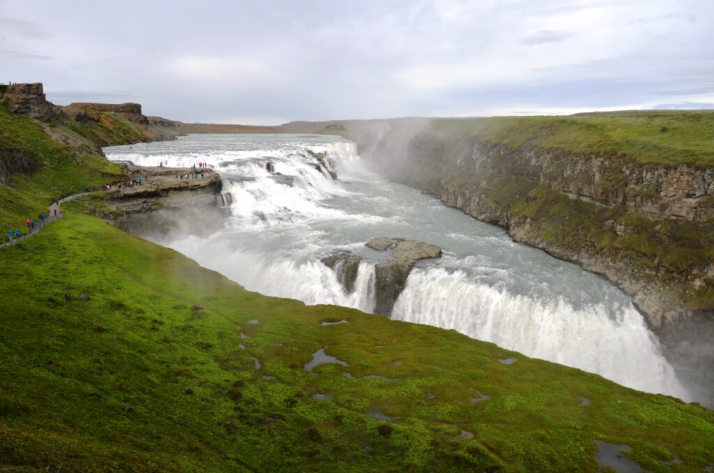
A whole day for everything the Golden Circle has to offer. You’ll be on the move the whole time, since a lot of the famous landmarks of Iceland are on the Golden Circle. The Golden Circle is also part of our 2 Days in Iceland.
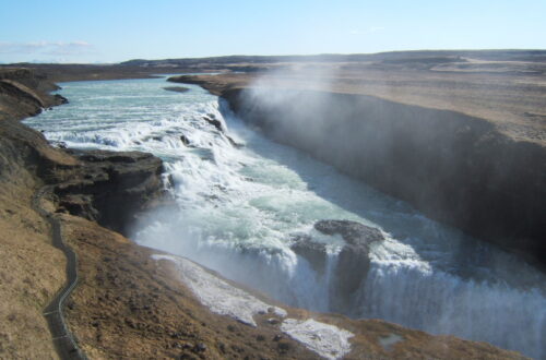
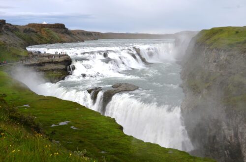
Start with Gulfoss, one of the most famous landmarks of Iceland. It’s a beautiful and powerful 2-step waterfall. You can get very close to the waterfall walking a path. Gulfoss means golden waterfall, we had it to ourselves back in 2006. Don’t expect that nowadays, it’s one of the popular attractions of Iceland.
The geysers of Haukadalur Valley are just 10 minutes driving away. It’s a geothermal area with mud pots, hot springs, fumaroles and geysers. There are over 40 in total. Geysir and Strokkur are the two main attractions. Geysir doesn’t erupt that often anymore, but is the original geyser that gave its name to the others. Strokkur erupts every 4 to 10 minutes and can reach heights of 30 meters/98 feet.

Then further to Bruarfoss. Only reachable through a hike. Hike through an Icelandic landscape of low bushes, mosses and grasses with mountains on the horizon. The hike to the waterfall takes about an hour.

Then drive to Þingvellir National Park via Laugarvatn, a lake with hot springs in it. Then pass Thingvallatn, the largest lake of Iceland. The national park is the place where the Eurasian and North American plates meet. The divide is clearly visible. This is also the place where the Alding started, the Icelandic parliament. Next to that you can admire another waterfall here, namely Oxararfoss.


Day 3: Southwest Iceland
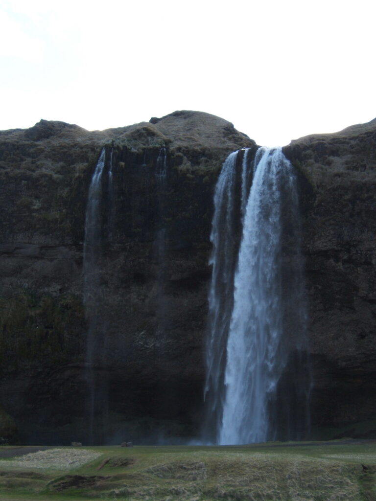
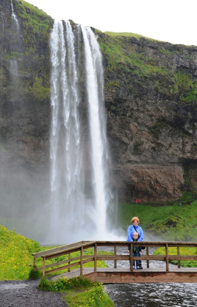
Southwest Iceland is rich with natural wonders and gives you the feeling you’re on another planet. Following the ring road you’re first stop is Seljalandsfoss. A 60 meter/197 feet high waterfall, which has a cave behind it, so you can walk behind the waterfall.

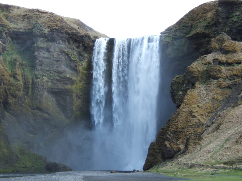
On to the next waterfall: Skógafoss. Again close to the ring road. This imposing waterfall has a drop of 60 meters/197 feet and a width of 25 meters/82 feet. Next to the fall are stairs, on top you can admire the top of the fall and enjoy the views on the coast.
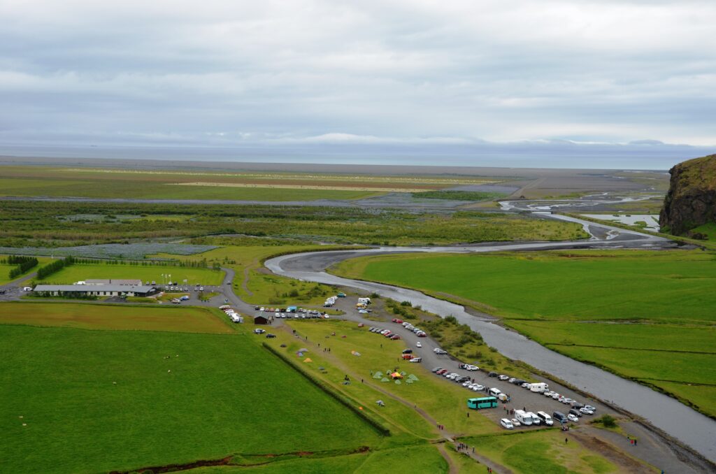
Next to Skógafoss is Skógasafn a museum with an open air part with peat houses, a folk museum and a museum on transport. All about how Icelandic people have lived during the centuries.

Vík
Driving further on route 1, stop at Sólheimajökull. Where you can see the end of this glacier.
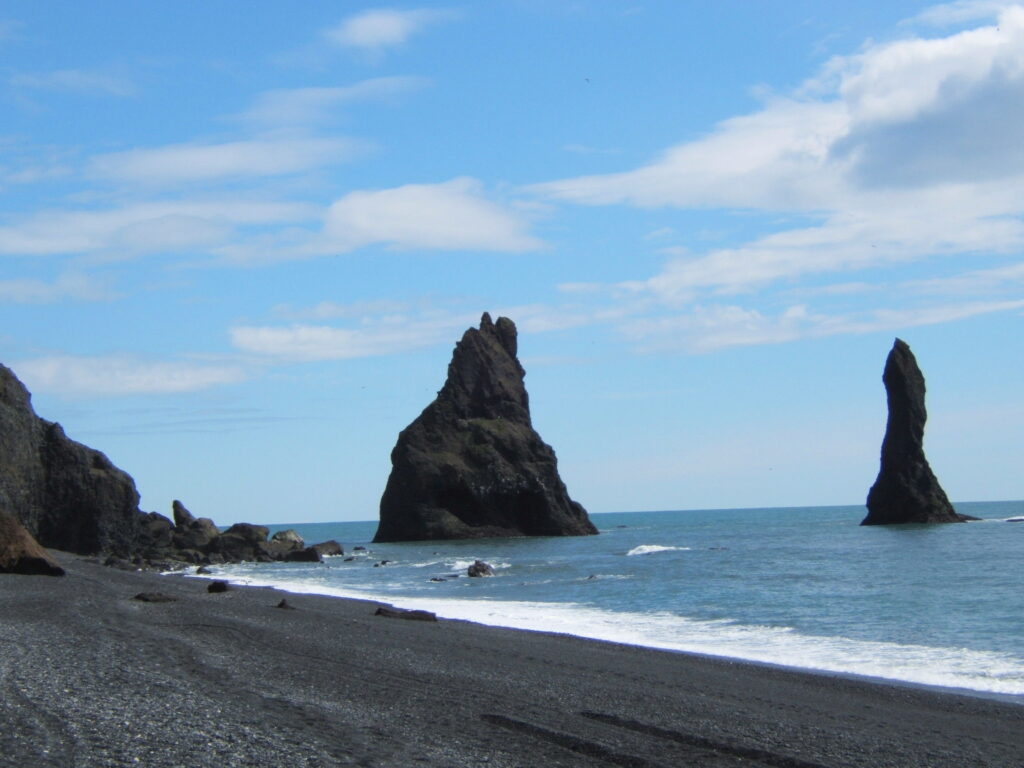
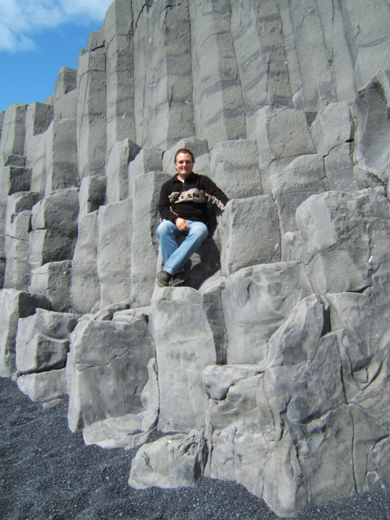
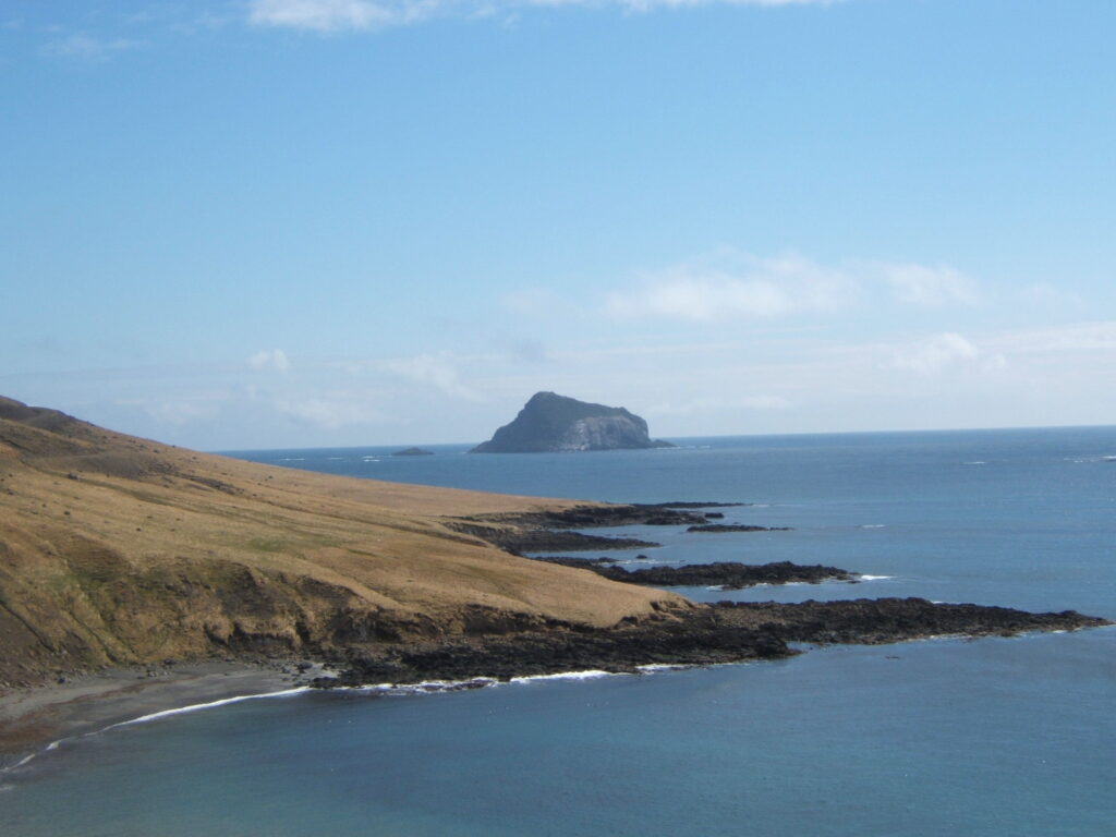
After this stop at the black sand beach, a black beach is a strange site to see. But the black sand isn’t the only highlight. Dyrhólaey, a cliff sticking out in the sea, is visible from here. We couldn’t visit it on our trip, since it was nesting season at that moment. The Reynisdrangar and Halsenefshellir however we could admire from up close. The Reynisdrangar are several rocks jutting out of the sea. The Halsenefshellir are shallow caves with basalt formations. Like everywhere else there are sagas on how these natural formations came to be.


Vík is the town that is the touristic hub in this part of Iceland. After this town you’ll think you’re on the moon or in Mordor. The Myrdalssandur is black lava with a bit of moss, which stretches on and on. The Eldhraun is a lava field with green moss. You drive through these landscapes on route 1. At Laufskálavarða, there are small towers of stones placed by travelers. We added some stones to the towers.


Day 4: Fjaðrárgljúfur + Snowmobile Tour
You stay for the night in Kirkjubæjarsklaustur, which is a mouthful and means churchfarmabbey. In the morning we visited Fjaðrárgljúfur. Which is a canyon near the town. It’s labeled the most beautiful canyon of Iceland. It’s 100 meters/328 feet deep and 2 kilometers/1.2 miles long. Back then this massive ancient canyon was hardly known among tourists. It wasn’t even mentioned in our guidebooks, the people of the farm we stayed on told us about it.

However the highlight on this day for us was the snowmobile tour on the Myrdalsjökull. We hadn’t driven a snowmobile before, neither been on top of a glacier. It was a fantastic experience. Part of the tour everything around us was white and it was snowing. This was about an hour back to Vík.


Day 5: Núpsstaður + Svartifoss + Jökulsárlón
Núpsstaður is a tiny teeny peat church from the 17th century. Which was lovely to see from the in- and outside.
Then further on to Skaftafell National Park. A beautiful park where we did the hike to Svartifoss, a waterfall dropping of a cliff with basalt formations.

After this hike drive further on route 1 to Jökulsárlón. The absolute highlight of this day. Make a boat tour on this glacier lake with an amphibious vehicle. We loved seeing the icebergs up close from the water. On the seaside of route 1 is Breiðamerkursandur (Diamond beach), a black sand beach where parts of the icebergs of the lake wash up on the beach. Back then it wasn’t really an attraction in itself this beach, it is nowadays.


Drive further to Djúpivogur on route 1.
Day 6: Fjords
Today we’re exploring the fjords in Eastern Iceland. The fjords are spectacular to see with cliffs and black sand beaches in between. Steinasafn Petru (Petra’s stone collection) is a fun stop.

After a few fjords the ring road goes inland again. At Egilsstaðir take the road towards Seyðisfjörður. There are numerous waterfalls along this road (the whole of island is full of waterfalls). Hike towards Gufufoss and Fardagafoss. Seyðisfjörður was back then a small fishing village with an iceblue colored church and 19th century wooden buildings. Since then it’s become the town from the British series Trapped and there’s a colorful zebra path towards the church.


Drive back to Egilsstaðir and to Hallormsstadur, with the only real forest in Iceland.
Day 7: Litlanesfoss + Hengifoss
Go on a hike towards these two waterfalls. You can see both falls already from afar. Litlanesfoss is the first waterfall you come across. A two-tier fall surrounded with hexagonal columns. Hengifoss is further away and is with 118 meters/387 feet one of the highest waterfalls in Iceland. The hike is beautiful, just don’t do like me and slip and fall in a creek. With the snow wet pants and shoes are really cold.


Day 8: Mývatn + Goðafoss
Drive on route 1 towards Mývatn, the area you’re going to explore today. The area of Mývatn has lots to offer. The first thing you’ll see is Hverir a geothermal site with fumaroles and mud pots. Warmth and an egg smell comes from them. It’s an otherworldly site to see. We walked here during a hailstorm, it was cold but at the same time it was also warm.

A bit further down the road is Mývatn Nature Baths. Not as famous as The Blue Lagoon, but the same idea. Natural baths above hot springs. Water which is warm and mineral rich. We swam here while it was snowing.

Then there are a couple of natural phenomena on and around Mývatn, which is a vulcanic lake. Leave route 1 for a little while and take the East and South road around the lake. You can walk around the Dimmuborgir, lava rocks in craggy shapes. The Klasar are lava formations in the water. The Skútustaðagígar are a row of pseudo-craters on the South side of the lake.


Back to route 1 and the last visit of this day is Goðafoss. It means waterfall of the gods. It’s a spectacular, half-round waterfall with a drop of 12 meters/39 feet.

Leave the 1 again to go up North, where we will be for 2 nights.
Another road trip with unpredictable weather, but beautiful nature is this Scotland itinerary.
Day 9: Húsavík
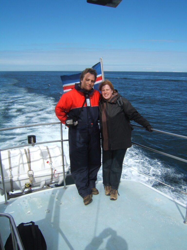
Spend the day in Húsavík, or rather on the water. You can take a whale watching safari from here. We had one booked, but due to North East wind it got canceled. Húsavík also has a Whale Museum, Exploration Museum and a beautiful wooden church.

Day 10: Akureyri
The largest city in the North. It has a nice church, a Motorcycle Museum and an Aviation Museum. The city is situated on a fjord.

At Örlygsstaðir is a memorial because the largest battle in Icelandic history took place here.

Day 11 till 13: Snæfellsnes
On your way to the Snæfellsnes peninsula visit Viðimýrarkirkja, a tiny church built from driftwood in 1834. You’ll also pass Vatnsdalshólar, a series of hills.


To reach and explore Snæfellsnes we’re leaving route 1 for a couple of days. Start your time on the peninsula with climbing Helgafell. A mountain which offers a beautiful panoramic view from on top. Legend says that if you don’t look back while climbing Helgafell then you get to have 3 wishes. Admire the harbor of Stykkishólmur.

The next day take a boat tour out of Stykkishólmur. You’ll see lots of different bird colonies while visiting several islands. You’ll also learn about the different sea creatures that live in the water.

Then onto the Beserkjahraun, a 4000 year old lava field. A little further North is the Bjarnarhöfn, the Shark Museum. You’ll learn everything about catching sharks. How they catch them and dry the sharks and use everything from the shark.

Last but not least at day 12 admire Kirkjufell, a 463 meter/1519 feet high mountain. It’s the most photographed mountain of Iceland. It has a distinctly shaped peak.

Last Day on Snæfellsnes
On day 13 start with bæjarfoss, it was frozen when we saw it. The morning is for the dramatic landscape of Snæfelsnes. Admire the crater Saxhóll. Drive inside Hólahólar, another crater. Visit Djúpalónssandur, a beach with impressive lava formations and fragments of a shipwreck from the 1950s. Then further to Lóndragar, which are the remains of a volcano.
Visit the cliffs with hundreds of birds at Hellnar. Don’t forget to visit the Bárðar Saga Snæfellsáss Statue at Arnarstapi, a monument. On the beach of Ytri-Tunga you can see sea lions. Gerðuberg has 2.5 kilometers/1.55 miles of basalt columns. They’re naturally shaped this way.


At last hike to Eldborg, a crater which you can climb and stand on the rim of it. The hike takes you through the Eldborgarhraun, a lava field.


Then you leave the peninsula and turn onto route 1 again.
Day 13: Hraunfossar + Barnafoss
Go a bit North and then off the ring road again. Visit Deildartunguhver, Hraunfossar and Barnafoss. The last two are waterfalls close to eachother. The first is the largest and most powerful hot spring in all of Europe. It’s next to a farm. The Hraunfossar are small waterfalls coming out of the lava field into the river. Barnafoss is surrounded with a legend, where it derives its name off, children’s waterfall. It consists of a series of rapids in a small gorge.


Make your way to Reykjavik on route 1.
Day 14: Reykjavik
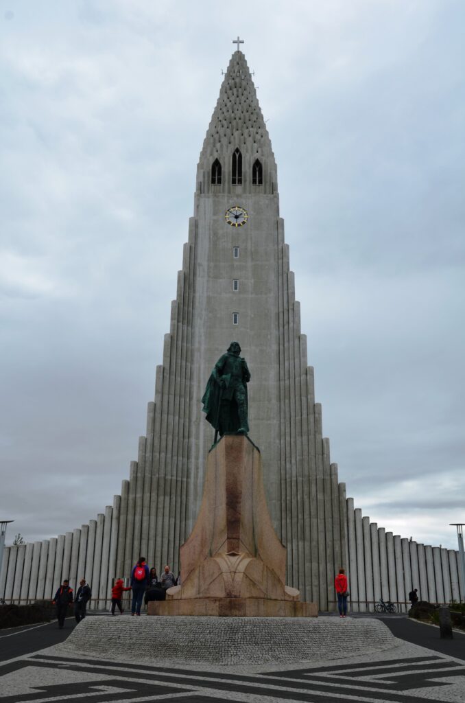
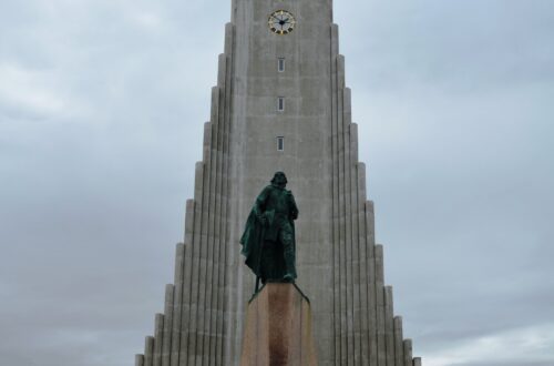
Explore Reykjavik, before flying back home from Keflavík Airport. Visit Solfar, the Sun Voyager, a statue of a modern vikingship. Don’t miss Hallgrímskirkja, the iconic church. We also did a whale watching safari at Reykjavik. Since the one in Húsavík got canceled. We saw whales and puffin colonies.

Fly back in the evening or early the next morning, like we did.
Where to Stay
We mostly stayed at guesthouses and a few hotels, which we all had pre-booked.
We stayed two nights at Syðra Langholt Guesthouse in Auðholtsvegur. Which was a perfect spot close to the Golden Circle. They had a hot tub in the garden.
At Hunkubakkar Guesthouse in Kirkjubæjarklaustur we stayed 2 nights. Which was in a farm, on walking distance of Fjaðrárgljúfur.
In Djúpivogur we stayed one night at Hótel Framtið. Which had a beautiful view on the bay.
Then 2 nights at Guesthouse Grái Hundurinn in Hallormsstadhur. Directly in the forest.
Hotel Raudaskrida in Þingeyjarsveit was by far our favorite hotel on our Iceland road trip route. We loved the hospitality of the host. We stayed here for 2 nights. When we left the hotel was covered in a layer of snow.


After this stay we had one night in Varmahlíd at Bakkaflöt Guesthouse.
We stayed two nights at North Star Hotel Ólafsvík.
We ended our stay in Iceland in Reykjavik at Baldursbrá Guesthouse.
Where to Eat
Our visit was in 2006 and back then there were less restaurants then nowadays. Besides lots of then were seasonal and still closed when we visited in May.
We mostly ate dinner at the guesthouses and hotels we stayed at. The only exception was the guesthouse in Reykjavik. We ate somewhere in the city. The others all offered dinner back in 2006, even if you were the only guest.
Hótel Framtið, Bakkaflöt Guesthouse, Hunkubakkar Guesthouse, Hotel Raudaskrida and North Star Hotel Ólafsvík have restaurants.
We had something to drink at Gamli Baukur restaurant, which had a cozy atmosphere and a view on the harbor.
What you have to try are the Icelandic hotdogs, Pylsur, you can get them at stands throughout the country.
When to Visit
We visited Iceland in May. It was early Spring in Iceland at that moment. We had temperatures in the South at about 10 to 13 degrees Celsius (50 to 56 Fahrenheit). We had sunny weather and some rain and wind.
On the East it was colder and more overcast weather.
In the North we had cold weather and snow. We had temperatures around zero and below to -8°C (32 to 17 Fahrenheit). We had snowstorms, hail and layers of snow. People did tell us that this was unusual weather for May.
A saying in Iceland about the weather is that it changes every 5 minutes. So pack with layers and for every weather type.
During our stay the roads to the inland of Iceland and some other roads, such as the one to Dettifoss where still closed, due to snow and waterboarding. Those roads are usually only open in the Summer months.

In Winter you can see the Northern Lights, but I don’t know if every road of this road trip can be driven than.
We had almost the whole day daylight, just a bit of dark hours. In the Summer it’s the whole day light for a while, and in Winter there’s almost no daylight. This would make it hard to drive and visit this route in this amount of days during Winter. In the Summer you profit from the long daylight, since you can drive until late in the evening and start early in the morning.
Hiring a Car and Airport
We hired a Rav4 Toyota 4×4 from Hertz at the Keflavík Airport. The 4×4 wasn’t needed on much of the ring road, but when we had heavy snowfall it was better for grip on the road and on some of the roads of the ring road.
The international airport you arrive at and leave from is Keflavík Airport. The only international airport in Iceland.
Tips
- Most waterfalls and other natural attractions don’t have an entrance fee. They’re also almost all open 24 hours a day. Visiting them is at your own risk.
- Take with you a hat, sunscreen, mittens, a woolen hat and scarf. We’ve used them all during our visit.
Alternative Itineraries
There are more attractions you can add along the route or swap other for:
Day 1: Swap visiting Reykjavik for The Blue Lagoon.
Day 2: Add Kerið, a crater, to your itinerary. It’s also part of the Golden Circle. You can drive at Þingvellir National Park, you do have to make reservations for this upfront.
Day 3: There’s another waterfall close to Seljalandsfoss, namely Gljúfrabúi. You have to walk past Seljalandsfoss and then it’s a bit further in the mountain. Behind Skógafoss are more waterfalls, you do have to hike to them. On the other side of Skógasafn is another waterfall, namely Kvernufoss. It’s a bit hidden.
Day 5: Add an ice cave tour in Vatnajökull. A glacier ice cave.
Day 8: Add Dettifoss and Selfoss to your itinerary. Dettifoss is the most powerful waterfall in Europe. The road towards Dettifoss and Selfoss was still buried in deep snow when we visited.
That’s Everything You Need to Know for Your Ring Road Iceland Itinerary
This road trip was perfect and made us fall in love with Iceland and with making road trips.
Like it? Pin it!


8 Comments
Cynthia/Adventuring Woman
A long road trip like this looks like the perfect way to see Iceland. The scenery is absolutely breathtaking! Your lovely photos are making me want to book a flight right now.
Terri
It is on my bucket list to do this drive for years. Maybe 2024. I enjoyed your post.
Anna Schaeffer
What a great itinerary! The snowy drive looks TERRIFYING though! omg!
Alanna
What a great itinerary! Taking the tour with an amphibuous vehicle sounds so unique and fun!
Hels
We loved our (much smaller ) Iceland road trip – and you are right about the weather, talk about 4 seasons in one day! Would absolutely love to go back and try to iceberg boat trip and snowmobile tour, and a winter trip to see the Northern Lights. Thanks for sharing your amazing adventure!
Jody
Looked like you had a wonderful trip! I have been to Iceland also and found it to be amazing! Would love to visit the East side of Iceland next trip! Great article!
Viola
Amazing itinerary! And such an impressive scenery! We’re going to visit Iceland in December 2023 – glad I found your post! My bucket list for Iceland keeps growing 😃
Sharyn
Iceland is on my bucket list. I would love to go on a snowmobile tour and see the waterfalls. Can’t wait, hopefully 2024!